3 public reviews
SELECT PILOT#6282Public listing
MISSION DOSSIER
Spyre Air
Enterprise-ready operatorLVL 83
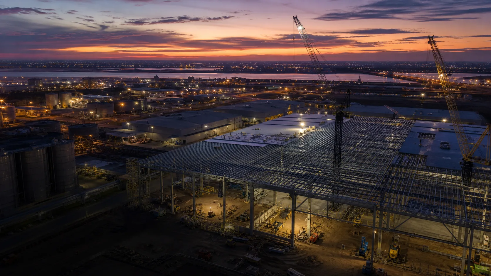
Experts in drone data capture, with 7 years experience in geospatial and cinematography solutions. As a fully licensed and insured drone company, we can help with - - LiDAR Surveys - Roof, Asset and Building Inspections - Aerial Mapping & Land Surveys - Stockpile Measurements - Construction Progress - Aerial Photography and Videography We have completed projects for both government and private sector clients in every Australian state, and we're ready to discuss your next project. For more inform
Primary roleCommercial propertyOperating zoneCECIL HILLS, NSWAircraft intelFleet pendingHandoffEdited visuals, select raw files, marketing handoff
Listed service lines
Strong public profile
Claim profile to list aircraft
Directory source record
Phone listed
PRO+ QUOTE ENGINE
Instant estimate from this pilot profile.
Clients can price the job before contacting the pilot. Pro+ operators can tune their real labour, vehicle, fuel, travel, and admin settings; the pilot still confirms the final scope.
Free profile - Pro+ requiredUnlock with Pro
Starting estimateLocked
Matched serviceProperty media
Travel basis3645 km from base
CAPABILITY MATRIX
What clients can confidently brief this operator for.
Edited visuals, select raw files, marketing handoff
Edited visuals, select raw files, marketing handoff
Evidence pack, marked findings, site handover
Evidence pack, marked findings, site handover
Evidence pack, marked findings, site handover
COVERAGE DESK
Base, travel signal, and operating context.
Actual mapCECIL HILLS, NSW-33.8861, 150.8577
BaseCECIL HILLS, NSW
-33.8861, 150.8577
Unknown until claimedAvailabilitySourceMedia proofdronesforhire.com.auSource record
OPERATOR NOTES
Condensed story for quick qualification.
Experts in drone data capture, with 7 years experience in geospatial and cinematography solutions. As a fully licensed and insured drone company, we can help with - - LiDAR Surveys - Roof, Asset and Building Inspections - Aerial Mapping & Land Surveys - Stockpile Measurements - Construction Progress - Aerial Photography and Videography We have completed projects for both government and private sector clients in every Australian state, and we're ready to discuss your next project. For more inform
Portfolio pendingSpyre Air
Claimed profiles can add job photos, reels, and proof of work.
Mission fitSpyre Air
Use services and checklist signals to qualify the operator.
Source recordSpyre Air
Imported public details stay visible until the pilot completes the profile.